
Trace a Hidalgo County Street Directory
Start with the entire address as received, including a unit when one is known. Hidalgo County records separate a mailing address, a property location, and a legal description, so the first match is only the start. The county tax portal, HCAD appraisal route, GIS layers, and County Clerk index each describe a different part of the same place. A dated property record can identify an owner of record or a grantee, but it does not by itself prove who occupied the address.
- Use USPS ZIP Lookup By Address to standardize the street, city, state, unit, and ZIP. Keep the original form of the address in your notes as well.
- Run the normalized street fragment in the Hidalgo County tax portal with Property Address (Starts With). Save the account and CAD reference returned for the property you are checking.
- Compare that result with the Hidalgo County Appraisal District property search and the county ArcGIS layers. Treat an owner, mailing address, and mapped parcel as separate evidence fields.
- Search the County Clerk Official Records Search by the grantee or grantor, then subdivision, document type, number, and date. Record the instrument number or volume and page before moving backward.
- For an older household snapshot, use dated directories, newspapers, and maps rather than a current record. The historical shelf is described in the Hidalgo County city directories.
Hidalgo County's Sample Ballot Lookup is a first-name, last-name, and date-of-birth tool for precinct and sample-ballot context. It is not a complete street roster, so it should not be used to fill an address list.
Normalize Hidalgo County Street Addresses
USPS is the postal starting point, not the parcel authority. Its By Address form takes a required street address, city and state, with optional company, apartment or suite, and ZIP fields. By City and State accepts those two fields; Cities by ZIP returns city names associated with a ZIP. USPS can return more than one standardized answer and says a business address result does not guarantee a physical business location. Narrow an ambiguous result before you use it in a public record search.
Split a supplied address into house number, direction, street name, street type, unit, city, state, and ZIP. Preserve that original string, then record the standardized postal version beside it. A rural route, a subdivision street, a highway label, and a deed call may describe the same general location in very different ways. If a historical record uses a survey or porción, retain that wording instead of forcing it into a modern street field.
Note: Postal city and legal municipality are distinct fields, especially when city-limit and ETJ status affect which office holds a permit or code record.
Hidalgo County Tax Search Fields
The accessible county tax portal is the confirmed address-search layer. It has one Step 1 text box with a Search By choice, plus an optional Step 2 to narrow the result. HCAD is the official appraisal route, but its live field labels and result columns were not exposed in the research. Do not borrow fields from the tax portal and call them HCAD fields.
| Tax portal control | How it works | Verified use or example |
|---|---|---|
| Owner Name | Step 1, last name first | smith mary |
| Property Address | Step 1 starts-with search | 905 Oak Park |
| Account No. | Step 1 identifier search | 304900000001 |
| CAD Reference No. | Step 1 identifier search | R071466 |
| Fiduciary No. | Step 1 option | 586590; the portal says it may take several minutes |
| Optional Step 2 | Owner, address, account, or CAD reference | Combine a surname with a street fragment, such as Jackson with Clearwater |
The portal offers payment and certified-statement paths after an account is found, and it disclaims accuracy and reliability. Check a tax result against HCAD and a recorded instrument. The research did not locate a portal coverage date, export rule, or page-limit statement.
Use the optional second step as a narrowing tool, not as a new source of identity. The portal's example of a Jackson owner name with a Clearwater street fragment illustrates a controlled combination search. It does not prove that every Jackson at a matching street is the same person. Save the returned account number and CAD reference, then compare the property location, owner mailing information, and legal description against HCAD and the Clerk record. That three-way check is especially useful when a street has a directional prefix, a unit number, a rural description, or a subdivision label that indexes differently.
Map Hidalgo County Streets Carefully
The county ArcGIS inventory names HC_Parcel, HC_Address_Points, the Hidalgo County Rural Addressing Map (Beta), City Limits, Hidalgo County City Limits, Edinburg Registered Voters, and floodplain layers. Use the address-point layer to locate a mapped point, City Limits to assess jurisdiction, and HC_Parcel to connect the place with parcel context. The HCAD appraisal-map item's metadata identifies the Planning Department as source and gives a June 14, 2022 data update plus a November 17, 2022 item update. Those dates do not promise the live layer is current.
The HCAD appraisal-map feature-service item is the source for this Hidalgo County parcel-viewer reference.
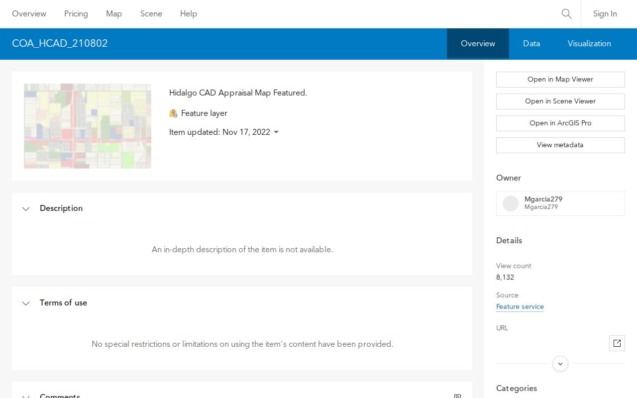
The screenshot supports a map-context check, not a claim that a live identify result, adjacent-parcel display, print function, or export control was captured. Those live controls and the layer refresh schedule remain research gaps.
For municipal permits, environmental assessments, or code-violation records, follow the county FAQ's custodian rule. HCAD can identify taxing jurisdictions; if the result lists a municipality, that city will most likely hold its city-specific records. For an unincorporated area, the county public-information route may be the better records channel.
Hidalgo County Street Record Layers
A street directory becomes more reliable when the record type stays visible. Some sources locate the place, while others document a transaction or a dated built environment. The table distinguishes what is actually verified in the research from fields that have not been captured on a live screen.
| Address-linked source | Verified coverage or status | What it can establish | Access channel |
|---|---|---|---|
| USPS ZIP Lookup | Current service; historical period not stated | Standard postal address | By Address, By City and State, or Cities by ZIP |
| County tax portal | Current portal; historical account period not stated | Owner, address fragment, account, CAD reference, fiduciary | Online search |
| HCAD | Online historical cutoff not stated | Official appraisal route | Online property search; live field details not captured |
| HC_Parcel and HC_Address_Points | Map item data date recorded in 2022; live refresh not stated | Mapped point and parcel context | ArcGIS layer inventory |
| County Clerk records | Portal certified through August 24, 2026; online start not stated | Recorded instruments and indexed parties | Online index, Clerk counter, or mail contact |
| TSL deed and map series | Deeds 1852-1888; supplement 1880-1912; surveys 1881-1941 | Older legal descriptions and maps | Texas State Library guide and UTRGV repository |
| LOC Sanborn maps | Mission 1933-1949 and 1925; McAllen 1925 | Dated structure and street context, not an occupancy list | Library of Congress map records |
Recorded data should be described with its date and role. A current tax account, a grantee in a deed, and an address in an old directory are not interchangeable statements about occupancy. When the goal becomes a house history instead of a street-by-street check, use the past-residents record trail.
Hidalgo County Deeds by Subdivision
The County Clerk's Official Records Search offers Quick and Advanced Search, recorded-date start and end fields, preset date ranges from 24 hours through one year, and an index-only or full-text OCR choice. Its property-record searches include grantor, grantee, subdivision, document type, and document number. Search both sides of a transfer, then save the document number or volume and page. A name in the index is not automatically the current owner.
A subdivision search begins with the subdivision name and a date range. Look for plats, declarations or restrictions, amendments, easements, and later conveyances. The McAllen Hidden Grove Estates planning example identifies a 5.492-acre subdivision, Map Records Volume 5, Page 39, and special warranty deed document numbers 3067851 and 3067864. It illustrates how a plat and deed can cross-reference, not a universal numbering rule.
The County Clerk is also an in-person and mail channel at 100 N Closner, Edinburg, with PO Box 58, Edinburg, TX 78540, and 956-318-2100. For older material, the Texas State Library guide places direct and reverse deed indexes, original and transcribed volumes, and maps on specific microfilm reels at UTRGV. The historical channel should not be assumed to be fully imaged online.
Hidalgo County Street Directory Terms
Address records use several labels for one place. Keeping them separate prevents a postal correction from being mistaken for a legal property change.
- Parcel
- A mapped unit of property used for appraisal and map context. It may be tied to a tax account but is not the same thing as a mailing address.
- Situs address
- The property-location address. Hidalgo County's correction form distinguishes it from the owner mailing address and legal description.
- Plat
- A recorded map that can show a subdivision, lot, block, streets, or related legal layout.
- Legal description
- The deed or property description that may use lot and block, acreage, a survey, or a porción rather than a familiar street label.
- Criss-cross directory
- An address-first section in a dated directory edition. The research describes the method, but did not verify a named countywide criss-cross holding.
Hidalgo County Street Map Tip
For a historical street label, pair the directory date with a map date. The Library of Congress records a six-sheet Mission Sanborn set dated 1933-1949 and an eight-sheet McAllen map dated March 1925. Check edition, sheet number, and nearby street names before treating a mapped building as the same modern address. A map can show structures and uses without naming an occupant.
An early record can also use a porción rather than a subdivision lot. The Hidalgo County Historical Collection's Porción 71 warranty deed to John Closner includes a legal description, grantor and grantee relationship, county-court signature, and embossed seal. Carry the original term into the deed and GIS search; only a later survey, plat, or parcel record may supply a defensible modern link.
Hidalgo County Street Myth Check
There is no located official year-by-year street-renumbering schedule, comprehensive annexation or renaming index, or countywide historical address-equivalency table. A current street match is not proof that an older document used the same number, street type, or municipal boundary. Search deeds, plats, Sanborn sheets, directories, city minutes, and USPS history, then label any match as an inferred equivalency unless an official renaming notice supports it.
The county-seat move is a useful jurisdiction clue, but not a street-renumbering event. The Old Hidalgo County Courthouse at First and Flora served from 1886 to 1908; the county seat then moved to Chapin, later Edinburg. An early record may therefore point to the older county-seat setting even when a modern lookup starts with Edinburg.
Note: Keep source dates with each street result because HCAD, tax, GIS, and Clerk systems have different update cycles and coverage gaps.
Hidalgo County Street Directory Limits
No verified countywide reverse-directory holding was located, and the research did not capture live HCAD field labels, ArcGIS identify results, parcel-neighbor display, or an official historical address conversion index. The County Clerk portal has a current certification marker, but it does not state the first date of online images. These gaps are part of an accurate street directory result, not reasons to fill in details from another source.
Use only the record needed for a lawful personal question, such as family history, an estate matter, a property-history check, or confirming a public document. Stop at a protected address, a redaction, or an uncertainty that cannot be resolved with the responsible custodian.
Lawful use. Hidalgo County address and property records should be used for personal, lawful research. Do not use a street record to stalk, harass, intimidate, or harm anyone.